History of Mughal Road, J&K
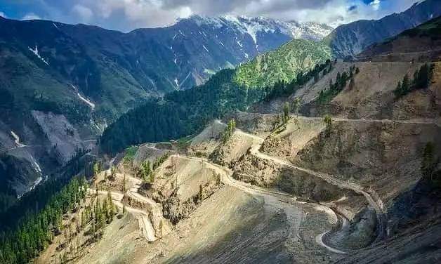
Mughal Road is the road between Bufliaz, a town in the Poonch district, to the Shopian district, in the union territory of Jammu and Kashmir.
The 84-kilometre road traces a historic route used in the Mughal period over the Pir Panjal Pass, at an altitude of 3,500 m (11,500 ft), higher than the Banihal pass at 2,832 m.
The road connects Poonch and Rajouri to Srinagar in the Kashmir valley, and reduces the distance between Shopian and Poonch from 588 km to 126 km. It also provides an alternative route into the Kashmir valley off the Jammu-Srinagar highway.
The road passes through Buffliaz, Behramgalla, Chandimarh, Poshana, Chattapani, Peer Ki Gali, Aliabad, Zaznar, Dubjan, Hirpora, and Shopian.
A route linking Hirapur (modern Hirpora) in the Kashmir Valley with Rajauri via the Pir Panjal Pass (Peer Ki Gali) has been use from ancient times. During the period of the sultans, it was extended to Bhimber. Historian Mohibbul Hasan says it played an important role during this period.
After conquering the Kashmir Valley, the emperor Akbar strengthened the route into an “Imperial Road” stretching from Lahore to Kashmir. In modern times, the route has been referred to as the “Mughal Road”.

Leave a comment